Haggersgate House information plate
Introduction
The photograph on this page of Haggersgate House information plate by Mike Kirby as part of the Geograph project.
The Geograph project started in 2005 with the aim of publishing, organising and preserving representative images for every square kilometre of Great Britain, Ireland and the Isle of Man.

There are currently over 7.5m images from over 14,400 individuals and you can help contribute to the project by visiting https://www.geograph.org.uk
Haggersgate House information plate
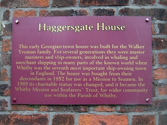
Image: © Mike Kirby Taken: 6 Jul 2011
Mounted on the wall to the left of the main entrance. See Image
Images are licensed for reuse under creativecommons.org/licenses/by-sa/2.0
Image Location
Latitude
54.487388
Longitude
-0.614846