Kilchoman
Introduction
The photograph on this page of Kilchoman by Gordon Hatton as part of the Geograph project.
The Geograph project started in 2005 with the aim of publishing, organising and preserving representative images for every square kilometre of Great Britain, Ireland and the Isle of Man.

There are currently over 7.5m images from over 14,400 individuals and you can help contribute to the project by visiting https://www.geograph.org.uk
Kilchoman
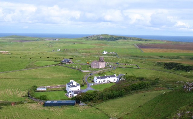
Image: © Gordon Hatton Taken: 21 Jul 2011
View over Kilchoman from the hill to the south. The scene includes the ruined and abandoned 19th century church which stands on a much older Christian site. In the foreground is Kilchoman House, formerly the manse for the church, and to the right is a row of holiday cottages. In the background a pattern of improved fields with peat bog to the right.
Images are licensed for reuse under creativecommons.org/licenses/by-sa/2.0
Image Location
Latitude
55.781451
Longitude
-6.441419