St Andrews Cross
Introduction
The photograph on this page of St Andrews Cross by Thomas Nugent as part of the Geograph project.
The Geograph project started in 2005 with the aim of publishing, organising and preserving representative images for every square kilometre of Great Britain, Ireland and the Isle of Man.

There are currently over 7.5m images from over 14,400 individuals and you can help contribute to the project by visiting https://www.geograph.org.uk
St Andrews Cross
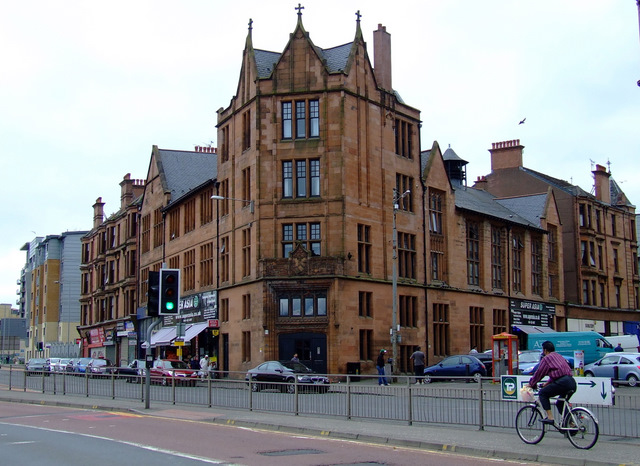
Image: © Thomas Nugent Taken: 31 Jul 2011
Built in 1894-6 for the YMCA, this ‘B’ Listed building at the corner of Pollokshaws Road and Maxwell Road has been converted to flats and ground floor retail use.
Images are licensed for reuse under creativecommons.org/licenses/by-sa/2.0
Image Location
Latitude
55.84288
Longitude
-4.262798