Tichborne Street
Introduction
The photograph on this page of Tichborne Street by Simon Carey as part of the Geograph project.
The Geograph project started in 2005 with the aim of publishing, organising and preserving representative images for every square kilometre of Great Britain, Ireland and the Isle of Man.

There are currently over 7.5m images from over 14,400 individuals and you can help contribute to the project by visiting https://www.geograph.org.uk
Tichborne Street
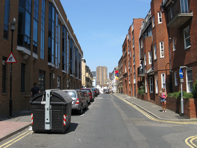
Image: © Simon Carey Taken: 31 Jul 2011
A small side street linking Church Street to North road that was built in the 1870s on the site of old slums known as Pimlico and Pym's gardens. During the 1980s the Bread Street development necessitated the removal of old houses on the western side. For a similar view in 1978 see http://regencysociety-jamesgray.com/volume25/source/jg_25_145.html
Images are licensed for reuse under creativecommons.org/licenses/by-sa/2.0
Image Location
Latitude
50.824938
Longitude
-0.140164