Clathan Power Station outfall
Introduction
The photograph on this page of Clathan Power Station outfall by David P Howard as part of the Geograph project.
The Geograph project started in 2005 with the aim of publishing, organising and preserving representative images for every square kilometre of Great Britain, Ireland and the Isle of Man.

There are currently over 7.5m images from over 14,400 individuals and you can help contribute to the project by visiting https://www.geograph.org.uk
Clathan Power Station outfall
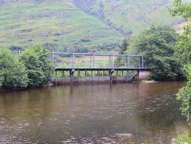
Image: © David P Howard Taken: 20 Jul 2011
The gates at the end of the outfall channel for the hydro power station. The fine screens are lowered to prevent salmon from swimming up the outfall channel.
Images are licensed for reuse under creativecommons.org/licenses/by-sa/2.0
Image Location


Leaflet Map data © OpenStreetMap
Latitude
56.274808
Longitude
-4.915534