Conwy Walls
Introduction
The photograph on this page of Conwy Walls by Colin Smith as part of the Geograph project.
The Geograph project started in 2005 with the aim of publishing, organising and preserving representative images for every square kilometre of Great Britain, Ireland and the Isle of Man.

There are currently over 7.5m images from over 14,400 individuals and you can help contribute to the project by visiting https://www.geograph.org.uk
Conwy Walls
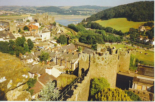
Image: © Colin Smith Taken: Unknown
Looking down along the line of the mediaeval town walls from their westernmost point. The walls are topped by a walkway and they have numerous round towers along their length. In the distance is Conwy Castle.
Images are licensed for reuse under creativecommons.org/licenses/by-sa/2.0
Image Location
Latitude
53.279473
Longitude
-3.832732