Carnet House, Belfast (1)
Introduction
The photograph on this page of Carnet House, Belfast (1) by Albert Bridge as part of the Geograph project.
The Geograph project started in 2005 with the aim of publishing, organising and preserving representative images for every square kilometre of Great Britain, Ireland and the Isle of Man.

There are currently over 7.5m images from over 14,400 individuals and you can help contribute to the project by visiting https://www.geograph.org.uk
Carnet House, Belfast (1)
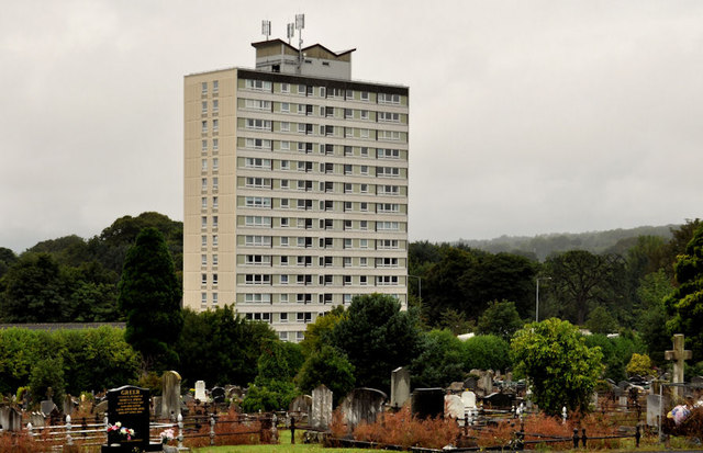
Image: © Albert Bridge Taken: 2 Aug 2011
A 15-storey block, at the Upper Newtownards Road (northern) end of the Ardcarn estate, between Belfast and Dundonald. Built by the Northern Ireland Housing Trust in the 1950’s and the only tall building in an estate of conventional houses. The best view (for photographic purposes) is this one from Dundonald Cemetery. Image shows the block after major renovation.
Images are licensed for reuse under creativecommons.org/licenses/by-sa/2.0
Image Location
Latitude
54.593561
Longitude
-5.823343