Thatched barn at Longstock
Introduction
The photograph on this page of Thatched barn at Longstock by Stefan Czapski as part of the Geograph project.
The Geograph project started in 2005 with the aim of publishing, organising and preserving representative images for every square kilometre of Great Britain, Ireland and the Isle of Man.

There are currently over 7.5m images from over 14,400 individuals and you can help contribute to the project by visiting https://www.geograph.org.uk
Thatched barn at Longstock
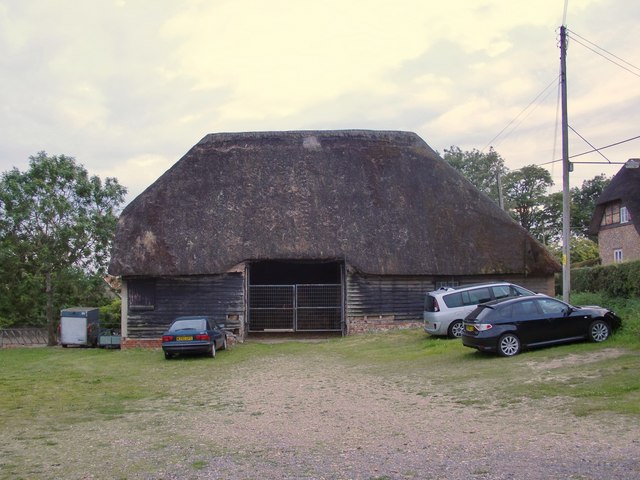
Image: © Stefan Czapski Taken: 31 Jul 2011
On the east side of the village street, north of Charity Farm House, at the edge of the flood-plain of the River Test. The barn is Grade II listed, the listing text suggesting a 17th or 18th century date http://www.britishlistedbuildings.co.uk/en-140208-barn-10-metres-north-of-charity-farm-hou. Many similar buildings survive across the southern counties, but most have had their original thatch replaced by tiles or slates. See, for instance: Image (on the Grain peninsula, North Kent) or Image (near Winchester).
Images are licensed for reuse under creativecommons.org/licenses/by-sa/2.0
Image Location
Latitude
51.134294
Longitude
-1.485863