The riverside at Greenhithe
Introduction
The photograph on this page of The riverside at Greenhithe by Marathon as part of the Geograph project.
The Geograph project started in 2005 with the aim of publishing, organising and preserving representative images for every square kilometre of Great Britain, Ireland and the Isle of Man.

There are currently over 7.5m images from over 14,400 individuals and you can help contribute to the project by visiting https://www.geograph.org.uk
The riverside at Greenhithe
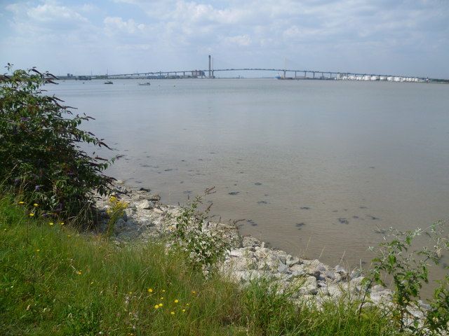
Image: © Marathon Taken: 1 Aug 2011
The riverside at Greenhithe is a pleasant place to be in summer with views upriver to the Queen Elizabeth II Bridge and downriver to Swanscombe and West Thurrock. The adjacent development at Ingress Park makes it a popular promenade. In the distance in this view is the Queen Elizabeth II Bridge carrying southbound traffic from the M25 across the Thames. The oil storage facilities are at Purfleet on the north bank of the river. Beyond the bridge is the chimney of the Littlebrook D Power Station which at 705 feet is the 4th tallest in the United Kingdom.
Images are licensed for reuse under creativecommons.org/licenses/by-sa/2.0
Image Location
Latitude
51.45424
Longitude
0.288472