Clydach Brook aqueduct, Resolven
Introduction
The photograph on this page of Clydach Brook aqueduct, Resolven by Jaggery as part of the Geograph project.
The Geograph project started in 2005 with the aim of publishing, organising and preserving representative images for every square kilometre of Great Britain, Ireland and the Isle of Man.

There are currently over 7.5m images from over 14,400 individuals and you can help contribute to the project by visiting https://www.geograph.org.uk
Clydach Brook aqueduct, Resolven
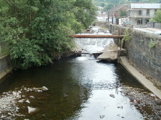
Image: © Jaggery Taken: 31 Jul 2011
Viewed from a footbridge. The small aqueduct, http://www.geograph.org.uk/photo/2532159 just behind the large-bore pipe across the water, conveys the brook above the Vale of Neath railway. http://www.geograph.org.uk/photo/2532167 Four rail-like structures in the aqueduct can be seen, at right angles to the pipe.
Images are licensed for reuse under creativecommons.org/licenses/by-sa/2.0
Image Location
Latitude
51.710795
Longitude
-3.6948