Grange Terrace
Introduction
The photograph on this page of Grange Terrace by Richard Dorrell as part of the Geograph project.
The Geograph project started in 2005 with the aim of publishing, organising and preserving representative images for every square kilometre of Great Britain, Ireland and the Isle of Man.

There are currently over 7.5m images from over 14,400 individuals and you can help contribute to the project by visiting https://www.geograph.org.uk
Grange Terrace
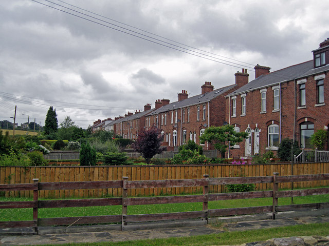
Image: © Richard Dorrell Taken: 26 Jul 2011
On this side of the houses are long gardens leading onto the B6313, Bluehouse Bank. At their backs (fronts?) is a further minor road, across which the houses have further land. The housing would have been built to provide homes for miners working in the many nearby coal mines. Nothing visible now remains here of the former mine workings.
Images are licensed for reuse under creativecommons.org/licenses/by-sa/2.0
Image Location
Latitude
54.858319
Longitude
-1.617855