Precision Demolition
Introduction
The photograph on this page of Precision Demolition by Karen Vernon as part of the Geograph project.
The Geograph project started in 2005 with the aim of publishing, organising and preserving representative images for every square kilometre of Great Britain, Ireland and the Isle of Man.

There are currently over 7.5m images from over 14,400 individuals and you can help contribute to the project by visiting https://www.geograph.org.uk
Precision Demolition
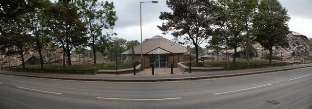
Image: © Karen Vernon Taken: 31 Jul 2011
A panorama of 3 photos showing how precise the demolition was. The small building in the centre, originally management offices I think, remains practically untouched while the buildings each side of it are just rubble. The only obvious damage I could see was the shelter on the right hand side and a few roof tiles also on the right hand side, presumably damaged by flying masonry. It was the left-hand side of these buildings which initially began to fall, which I assume explains the damage to the roof.
Images are licensed for reuse under creativecommons.org/licenses/by-sa/2.0
Image Location
Latitude
56.468406
Longitude
-2.971379