The Old Channel Road, Belfast (1)
Introduction
The photograph on this page of The Old Channel Road, Belfast (1) by Albert Bridge as part of the Geograph project.
The Geograph project started in 2005 with the aim of publishing, organising and preserving representative images for every square kilometre of Great Britain, Ireland and the Isle of Man.

There are currently over 7.5m images from over 14,400 individuals and you can help contribute to the project by visiting https://www.geograph.org.uk
The Old Channel Road, Belfast (1)
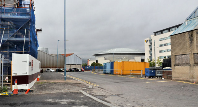
Image: © Albert Bridge Taken: 31 Jul 2011
Belfast harbour has seen many changes since the building of the first quay in 1613. Major redevelopment started in the mid-1800’s and continued with the growth of industrial Belfast. The Old Channel Road, which runs parallel to the Sydenham Road Image and is close to the Harland & Wolff building dock http://www.geograph.org.uk/snippet/4650 seems to have come into existence towards the end of the 19th century as a site for a coal yard. Now remote from the main dry-cargo handling area, on the other side of the Lagan, it is the site of various businesses, notably connected with construction. The view is towards Queen’s Quay. Buildings (for reference points) in the background are: the Obel Tower Image (on the right of the scaffolding), the Odyssey Image (middle right) and the Gateway Building Image (second right). Continue to Image
Images are licensed for reuse under creativecommons.org/licenses/by-sa/2.0
Image Location
Latitude
54.602737
Longitude
-5.910607