The old Woodside station from Woodside Tramlink stop
Introduction
The photograph on this page of The old Woodside station from Woodside Tramlink stop by Marathon as part of the Geograph project.
The Geograph project started in 2005 with the aim of publishing, organising and preserving representative images for every square kilometre of Great Britain, Ireland and the Isle of Man.

There are currently over 7.5m images from over 14,400 individuals and you can help contribute to the project by visiting https://www.geograph.org.uk
The old Woodside station from Woodside Tramlink stop
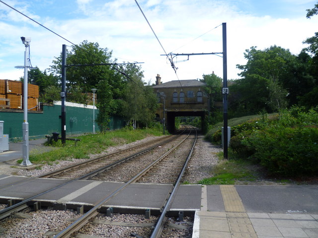
Image: © Marathon Taken: 25 Jul 2011
The railway line from Beckenham via Woodside to Addiscombe Road Croydon was opened on 1st April 1864. In 1885, a line opened from Woodside to South Croydon and after that Addiscombe (as it eventually became after 1955) was on the end of a branch from Woodside. The Woodside & South Croydon Line was closed in 1983, but the line from Elmers End via Woodside to Addiscombe remained open, although there was little demand with some off peak trains running empty. By 1993, Woodside station had become unstaffed and Addiscombe booking office was only open during the morning peak hours. Following the announcement that the line from Elmers End to Woodside was to be incorporated into the Croydon Tramlink scheme, it was clear that the line from Woodside to Addiscombe would close. The last day of service was Saturday 31st May 1997 and the Tramlink service through Woodside and on to Croydon began in 2000. The Tramlink stop is just south of the old station and the photograph is taken from the end of the platform looking across the foot crossing. The roadside building of the old station, the back of which is seen here, still stands, although it is disused, boarded up and covered in graffiti. The stairway to the former up platform to the left is still in use to provide access to the tram station. The stairway to the former down platform is fenced off. The rear wall of the up platform building has been kept as a retaining wall and as can be seen is now painted dark green.
Images are licensed for reuse under creativecommons.org/licenses/by-sa/2.0
Image Location
Latitude
51.387224
Longitude
-0.064853