Charity Farm House, Longstock, from the north-west
Introduction
The photograph on this page of Charity Farm House, Longstock, from the north-west by Stefan Czapski as part of the Geograph project.
The Geograph project started in 2005 with the aim of publishing, organising and preserving representative images for every square kilometre of Great Britain, Ireland and the Isle of Man.

There are currently over 7.5m images from over 14,400 individuals and you can help contribute to the project by visiting https://www.geograph.org.uk
Charity Farm House, Longstock, from the north-west
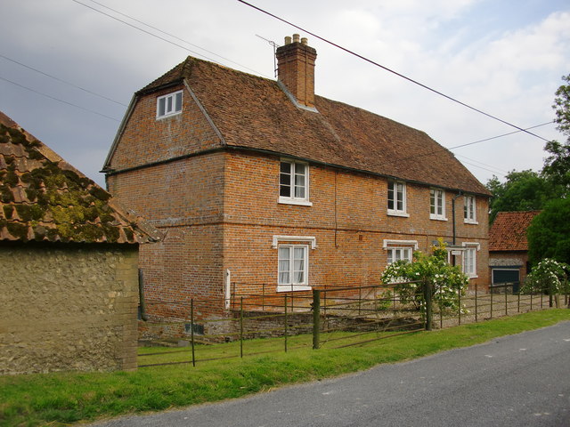
Image: © Stefan Czapski Taken: 28 Jul 2011
This is no longer a working farm, but served until recently as part of the accommodation of the Leckford Estate. Its location is interesting: not an isolated farmstead, but in the main village street (which runs north-south, along the valley of the River Test). From its external appearance it would be hard to guess at the building's history, but the Listing Text (Grade II) suggests it has 17th century origins, with perhaps an old timber-framed core http://www.britishlistedbuildings.co.uk/en-140207-charity-farm-house-longstock.
Images are licensed for reuse under creativecommons.org/licenses/by-sa/2.0
Image Location
Latitude
51.134562
Longitude
-1.485574