Flush Bracket, Portstewart
Introduction
The photograph on this page of Flush Bracket, Portstewart by Rossographer as part of the Geograph project.
The Geograph project started in 2005 with the aim of publishing, organising and preserving representative images for every square kilometre of Great Britain, Ireland and the Isle of Man.

There are currently over 7.5m images from over 14,400 individuals and you can help contribute to the project by visiting https://www.geograph.org.uk
Flush Bracket, Portstewart
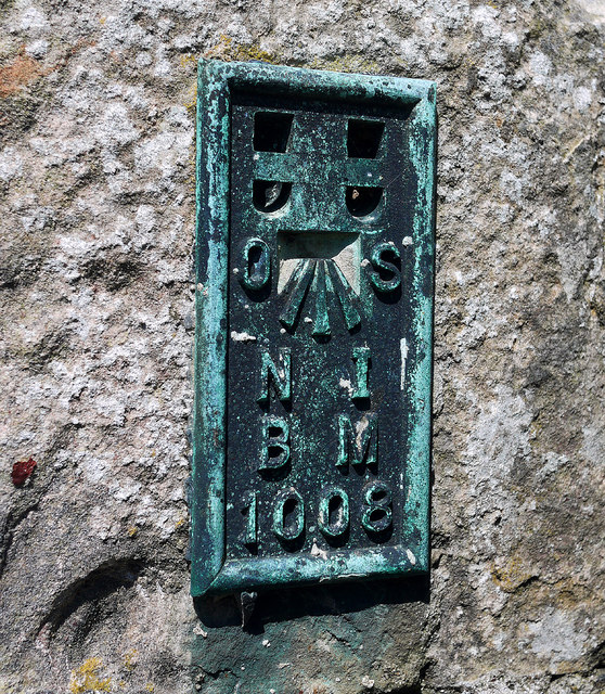
Image: © Rossographer Taken: 24 Jul 2011
Flush bracket bench mark, it is located on Agherton Parish Church, Portstewart Image The number on the bracket is OSNIBM 1008. The mark is 14.00 metres above MSL. OSNI produced an initial run of flush brackets numbered 1001-1025 that were used c1932-1936; of these, 21 were sited in the greater Belfast area and 4 in County Londonderry. This is the only remaining bracket from the 4 located outside Belfast still in existence - the other 3 were all sited in the Toome area but have been destroyed. OSNI later used flush brackets in much greater numbers for the retriangulation and levelling of Northern Ireland in the 1950s and early 1960s. See also Image
Images are licensed for reuse under creativecommons.org/licenses/by-sa/2.0
Image Location
Latitude
55.18276
Longitude
-6.717964