Ecclesfield Priory
Introduction
The photograph on this page of Ecclesfield Priory by Jonathan Clitheroe as part of the Geograph project.
The Geograph project started in 2005 with the aim of publishing, organising and preserving representative images for every square kilometre of Great Britain, Ireland and the Isle of Man.

There are currently over 7.5m images from over 14,400 individuals and you can help contribute to the project by visiting https://www.geograph.org.uk
Ecclesfield Priory
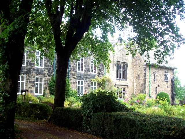
Image: © Jonathan Clitheroe Taken: 28 Jul 2011
Medieval priory, dating back to at least 1273 and originally attached to the Benedictine St Wadrille's Abbey in Normandy. The priory was extensively altered in 1866 and what can be seen here is the chapel (right), the main priory block (centre-right) and the later Ecclesfield Hall on the left.
Images are licensed for reuse under creativecommons.org/licenses/by-sa/2.0
Image Location
Latitude
53.443669
Longitude
-1.471071