Temple Bar
Introduction
The photograph on this page of Temple Bar by Rob Candlish as part of the Geograph project.
The Geograph project started in 2005 with the aim of publishing, organising and preserving representative images for every square kilometre of Great Britain, Ireland and the Isle of Man.

There are currently over 7.5m images from over 14,400 individuals and you can help contribute to the project by visiting https://www.geograph.org.uk
Temple Bar
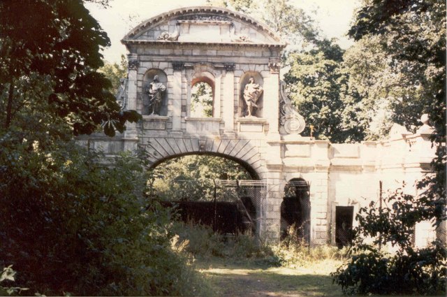
Image: © Rob Candlish Taken: Unknown
A view of the Temple Bar taken from the side not normally seen when it was in Theobalds Park, Cheshunt as it was fenced off and surrounded by dense undergrowth.
Images are licensed for reuse under creativecommons.org/licenses/by-sa/2.0
Image Location
Latitude
51.6914
Longitude
-0.056826