Cullompton Hill, milestone and bus shelter
Introduction
The photograph on this page of Cullompton Hill, milestone and bus shelter by David Smith as part of the Geograph project.
The Geograph project started in 2005 with the aim of publishing, organising and preserving representative images for every square kilometre of Great Britain, Ireland and the Isle of Man.

There are currently over 7.5m images from over 14,400 individuals and you can help contribute to the project by visiting https://www.geograph.org.uk
Cullompton Hill, milestone and bus shelter
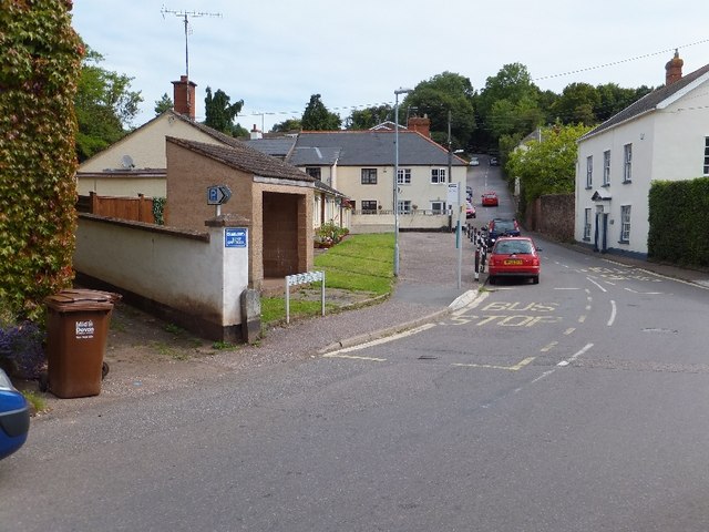
Image: © David Smith Taken: 26 Jul 2011
The milestone records that Exeter is 10 miles distant. Formerly, Bradninch was on the main road from Taunton to Exeter, but for the last two centuries, the village has been bypassed. A correspondent, Jon Kington wrote: "I was born in the white house on the right and spent my early childhood there. Originally it was a pub called the Bradninch Arms and there was a range of buildings, including a ballroom and skittle alley, surrounding a cobbled yard behind the wall at the end, they were built of cob (as is the house) and they all suddenly collapsed in a storm one night. Opposite, where the bungalows are, was waste land."
Images are licensed for reuse under creativecommons.org/licenses/by-sa/2.0
Image Location
Latitude
50.828594
Longitude
-3.420113