View south-east from Martinsell Hill. near Clench
Introduction
The photograph on this page of View south-east from Martinsell Hill. near Clench by Brian Robert Marshall as part of the Geograph project.
The Geograph project started in 2005 with the aim of publishing, organising and preserving representative images for every square kilometre of Great Britain, Ireland and the Isle of Man.

There are currently over 7.5m images from over 14,400 individuals and you can help contribute to the project by visiting https://www.geograph.org.uk
View south-east from Martinsell Hill. near Clench
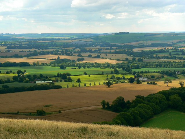
Image: © Brian Robert Marshall Taken: 24 Jul 2011
The view takes in several gridsquares. Visible at the lower left is a windpump at SU182633 and above that is Clench Farm at SU186629. The woodland at the lower right is part of Broomsgrove Wood which straddles the conjunction of four squares, SU1763, 1863, 1762 and 1862.
Images are licensed for reuse under creativecommons.org/licenses/by-sa/2.0
Image Location


Leaflet Map data © OpenStreetMap
Latitude
51.363968
Longitude
-1.735663