The Church of St Mabena
Introduction
The photograph on this page of The Church of St Mabena by Rod Allday as part of the Geograph project.
The Geograph project started in 2005 with the aim of publishing, organising and preserving representative images for every square kilometre of Great Britain, Ireland and the Isle of Man.

There are currently over 7.5m images from over 14,400 individuals and you can help contribute to the project by visiting https://www.geograph.org.uk
The Church of St Mabena
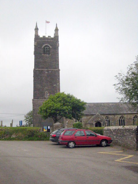
Image: © Rod Allday Taken: 24 Jul 2011
Grade I Listed, St Mabyn's parish church is probably of Norman origin, with the font surviving. The existing fabric probably dates largely from the late C15. The tower is 75 feet high.
Images are licensed for reuse under creativecommons.org/licenses/by-sa/2.0
Image Location
Latitude
50.525636
Longitude
-4.764358