The Halve, Trowbridge
Introduction
The photograph on this page of The Halve, Trowbridge by Derek Harper as part of the Geograph project.
The Geograph project started in 2005 with the aim of publishing, organising and preserving representative images for every square kilometre of Great Britain, Ireland and the Isle of Man.

There are currently over 7.5m images from over 14,400 individuals and you can help contribute to the project by visiting https://www.geograph.org.uk
The Halve, Trowbridge
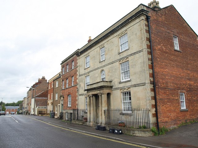
Image: © Derek Harper Taken: 20 Jul 2011
Listed buildings on the northeast side of the street. The nearest is the early C19 number 13, with distinctive double scroll shaping to the window recesses http://www.britishlistedbuildings.co.uk/en-314034-13-trowbridge . Next door is the older number 14 http://www.britishlistedbuildings.co.uk/en-314035-14-trowbridge .
Images are licensed for reuse under creativecommons.org/licenses/by-sa/2.0
Image Location
Latitude
51.322367
Longitude
-2.203153