Flush Bracket, Coleraine
Introduction
The photograph on this page of Flush Bracket, Coleraine by Rossographer as part of the Geograph project.
The Geograph project started in 2005 with the aim of publishing, organising and preserving representative images for every square kilometre of Great Britain, Ireland and the Isle of Man.

There are currently over 7.5m images from over 14,400 individuals and you can help contribute to the project by visiting https://www.geograph.org.uk
Flush Bracket, Coleraine
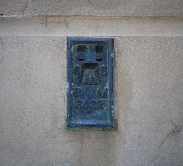
Image: © Rossographer Taken: 23 Jul 2011
Flush bracket bench mark located on the northern side of the old Town Hall in The Diamond, Coleraine Image The number on the bracket is OSBM 3422. The mark is 9.04 metres above MSL. A flush bracket is a type of bench mark set onto the face of a building. See also http://www.geograph.org.uk/search.php?i=11037856 for many other examples I have found.
Images are licensed for reuse under creativecommons.org/licenses/by-sa/2.0
Image Location
Latitude
55.131625
Longitude
-6.671501