Band Room of the Nantlle Vale Royal Silver Band, Talysarn
Introduction
The photograph on this page of Band Room of the Nantlle Vale Royal Silver Band, Talysarn by Eric Jones as part of the Geograph project.
The Geograph project started in 2005 with the aim of publishing, organising and preserving representative images for every square kilometre of Great Britain, Ireland and the Isle of Man.

There are currently over 7.5m images from over 14,400 individuals and you can help contribute to the project by visiting https://www.geograph.org.uk
Band Room of the Nantlle Vale Royal Silver Band, Talysarn
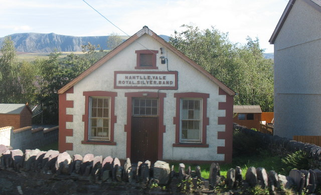
Image: © Eric Jones Taken: 8 Sep 2006
Bands played an important part in the culture of the slate quarrying areas, and still do today, if to a lesser extent. Nantlle Vale Silver Band was formed in 1865. It became Royal in 1894 when it played on the quayside in Caernarfon as the Prince and Princess of Wales glided past in the Royal Yacht. It is still very much alive today. http://www.bandnantlle.org.uk The mountain in the background in Craig Cwm Silyn.
Images are licensed for reuse under creativecommons.org/licenses/by-sa/2.0
Image Location
Latitude
53.052839
Longitude
-4.255814