Mortlake High Street
Introduction
The photograph on this page of Mortlake High Street by Stefan Czapski as part of the Geograph project.
The Geograph project started in 2005 with the aim of publishing, organising and preserving representative images for every square kilometre of Great Britain, Ireland and the Isle of Man.

There are currently over 7.5m images from over 14,400 individuals and you can help contribute to the project by visiting https://www.geograph.org.uk
Mortlake High Street
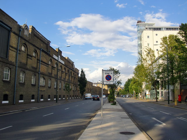
Image: © Stefan Czapski Taken: 22 Jul 2011
Looking east, with the brewery, on its riverside site, on the left. As High Streets go, this has got to be one of the dreariest, with very few shops and just one pub. Nearby you can find Tinderbox Alley, Vineyard Path and Tapestry Court, whose names suggest a more interesting past. But on the ground, there are few traces of it: the parish church, a few Georgian houses, some converted industrial buildings along the riverside. The brewers Phillips and Wigan had demolished much of the old riverside village by the time the brewery was built, in 1869. These days the local shopping centre - 'Sheen shops' - starts round the corner in Sheen Lane, but extends on a larger scale along Upper Richmond Road West. The railway station which serves it is still known as 'Mortlake' - a fact which surprises people unfamiliar with the area. It has to be said that this is a district where place names have a tendency to wander. Richmond was known as Sheen up until about 1500, when Henry VII built a new palace there. A hamlet about a mile south of Mortlake became known as East Sheen, but the name later attached itself to the suburb which grew up along the Upper Richmond Road. These days the 'East' is frequently forgotten, and the place is known simply as Sheen.
Images are licensed for reuse under creativecommons.org/licenses/by-sa/2.0
Image Location
Latitude
51.469841
Longitude
-0.264231