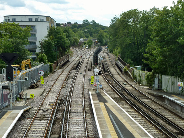
Railway junction at Tulse Hill
Introduction
The photograph on this page of Railway junction at Tulse Hill by Robin Webster as part of the Geograph project.
The Geograph project started in 2005 with the aim of publishing, organising and preserving representative images for every square kilometre of Great Britain, Ireland and the Isle of Man.
There are currently over 7.5m images from over 14,400 individuals and you can help contribute to the project by visiting https://www.geograph.org.uk

Image: © Robin Webster Taken: 23 Jul 2011
A close look at the points of the double junction ahead came as a bit of a shock. There are four possible settings for such a junction, three intrinsically safe and one unsafe. The safe settings are both tracks set left; both tracks set right; left set left with right set right. The settings as photographed are left set right, right set left. This produces a potential collision at the diamond crossing. Obviously signals and supposedly fail-safe train control devices would or should prevent this, but it is still disturbing.

