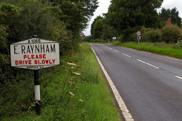
Entering East Raynham
Introduction
The photograph on this page of Entering East Raynham by Tiger as part of the Geograph project.
The Geograph project started in 2005 with the aim of publishing, organising and preserving representative images for every square kilometre of Great Britain, Ireland and the Isle of Man.
There are currently over 7.5m images from over 14,400 individuals and you can help contribute to the project by visiting https://www.geograph.org.uk

Image: © Tiger Taken: 23 Jul 2011
A modern village sign but in pre-Worboys style, complete with black-and-white pole but with the exhortation to drive slowly picked out in red, greets travellers heading coastwards on this unimproved section of the A1065 primary route. Not quite what it seems! A contributor has pointed out that the only national exceptions which do count as pre-Worboys were the ones with the name in the middle and nearby places above and below, which thus doubled as direction signs and appeared in the manuals of the time. Otherwise all other nameplates regardless of age are local issue and exempt from any national rules.

