The Woolpack Inn, Worle
Introduction
The photograph on this page of The Woolpack Inn, Worle by Jaggery as part of the Geograph project.
The Geograph project started in 2005 with the aim of publishing, organising and preserving representative images for every square kilometre of Great Britain, Ireland and the Isle of Man.

There are currently over 7.5m images from over 14,400 individuals and you can help contribute to the project by visiting https://www.geograph.org.uk
The Woolpack Inn, Worle
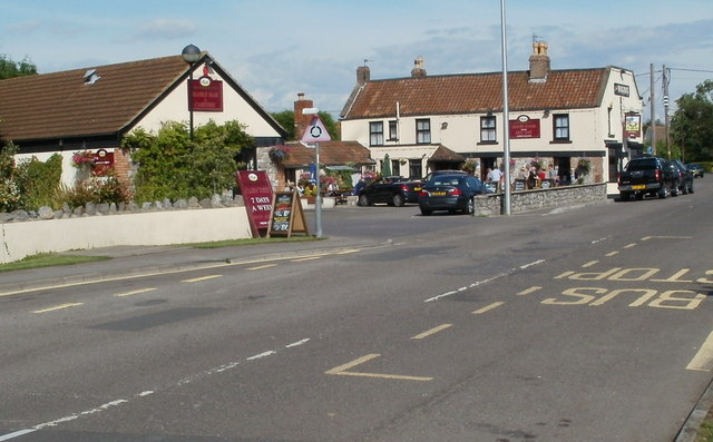
Image: © Jaggery Taken: 23 Jul 2011
Located on Shepherds Way, St. Georges, Worle, at the SE edge of Weston-super-Mare. The former uses of the Woolpack include a 17th century coaching house, and a wool packing station which served local farmers by baling wool for the northern mills. Currently, the part of the premises at the left edge of the view is The Stable bar and carvery. The section farther away is the pub.
Images are licensed for reuse under creativecommons.org/licenses/by-sa/2.0
Image Location
Latitude
51.358994
Longitude
-2.901885