Gover Valley
Introduction
The photograph on this page of Gover Valley by Graham Horn as part of the Geograph project.
The Geograph project started in 2005 with the aim of publishing, organising and preserving representative images for every square kilometre of Great Britain, Ireland and the Isle of Man.

There are currently over 7.5m images from over 14,400 individuals and you can help contribute to the project by visiting https://www.geograph.org.uk
Gover Valley
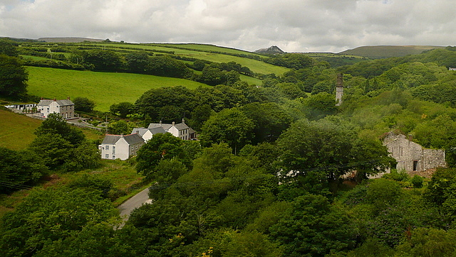
Image: © Graham Horn Taken: 9 Jul 2011
This view from the Gover railway viaduct shows a valley once busy with the china clay industry, note the chimney, but now returning to an intense greenness. This photo was taken from the 1158 Penzance to London Paddington train, having left Truro at 1244 and about to arrive at St Austell.
Images are licensed for reuse under creativecommons.org/licenses/by-sa/2.0
Image Location
Latitude
50.343674
Longitude
-4.816465