1 - 10 Romney Place
Introduction
The photograph on this page of 1 - 10 Romney Place by David Anstiss as part of the Geograph project.
The Geograph project started in 2005 with the aim of publishing, organising and preserving representative images for every square kilometre of Great Britain, Ireland and the Isle of Man.

There are currently over 7.5m images from over 14,400 individuals and you can help contribute to the project by visiting https://www.geograph.org.uk
1 - 10 Romney Place
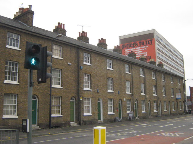
Image: © David Anstiss Taken: 20 Jul 2011
An early to mid C19 Grade II listed terrace on Romney Place. Most of the houses have been divided into offices. See http://www.britishlistedbuildings.co.uk/en-173459-1-10-maidstone for more details. In the background is Kent House office block.
Images are licensed for reuse under creativecommons.org/licenses/by-sa/2.0
Image Location
Latitude
51.271632
Longitude
0.526705