Remains of the Nottingham Canal
Introduction
The photograph on this page of Remains of the Nottingham Canal by John Sutton as part of the Geograph project.
The Geograph project started in 2005 with the aim of publishing, organising and preserving representative images for every square kilometre of Great Britain, Ireland and the Isle of Man.

There are currently over 7.5m images from over 14,400 individuals and you can help contribute to the project by visiting https://www.geograph.org.uk
Remains of the Nottingham Canal
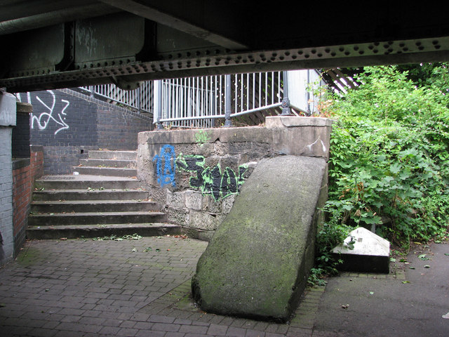
Image: © John Sutton Taken: 12 Jul 2011
Before the Nottingham Canal was abandoned north of Lenton in 1937 there was a lock immediately north of Wollaton Road at Radford Bridge. At the same time the Middleton and Western Boulevard sections of the Nottingham ring road were being built and the original canal bridge was replaced by a much wider girder bridge, similar in style to those crossing the railway at Western Boulevard, Bobbers Mill and Basford. The bridge is now a pedestrian subway. I don't know enough about canals to know what - if any - part of the lock or wharf the masonry straight ahead once was and I am far too old to appreciate the graffiti. It is instructive to look at old OS maps of this area to see how much it has changed in the last century.
Images are licensed for reuse under creativecommons.org/licenses/by-sa/2.0
Image Location
Latitude
52.955084
Longitude
-1.19289