Radford Bridge Road: the south side of the railway bridge
Introduction
The photograph on this page of Radford Bridge Road: the south side of the railway bridge by John Sutton as part of the Geograph project.
The Geograph project started in 2005 with the aim of publishing, organising and preserving representative images for every square kilometre of Great Britain, Ireland and the Isle of Man.

There are currently over 7.5m images from over 14,400 individuals and you can help contribute to the project by visiting https://www.geograph.org.uk
Radford Bridge Road: the south side of the railway bridge
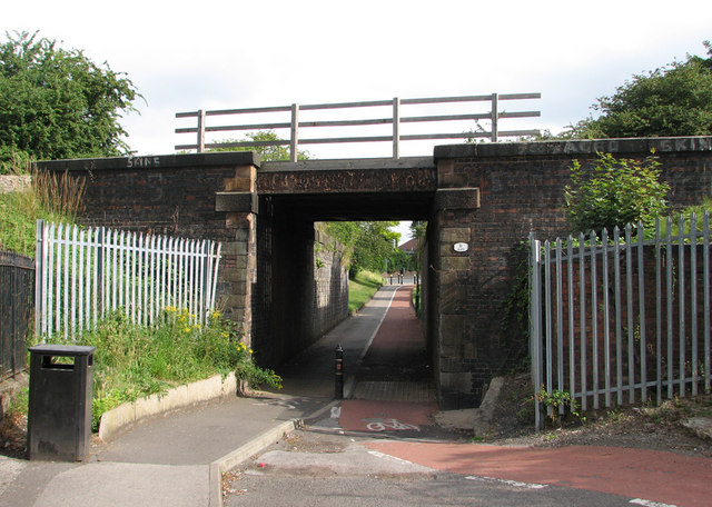
Image: © John Sutton Taken: 12 Jul 2011
The bridge carries the line from Radford Junction to Trowell Junction on the Erewash Valley Line, which was built by the Midland Railway in 1875 to enable trains to and from the north to avoid the bottlenecks at Trent and Toton. It also served Wollaton Colliery (1873-1965). This area was once called Radford Woodhouse, but its three Victorian terraces (to the right), Gate, Vane and Leavers Street, were demolished long ago and replaced more recently by streets named after railway locomotive engineers: Aspinall Court, Lambie Close and Peppercorn Gardens. None of these designers had any connexion with the Midland, so the council officials who chose them were less on-the-ball than when naming streets on former Great Northern Railway land at Sneinton after Gresley and Ivatt. For a view of the other side of the bridge and more railway history, see Image
Images are licensed for reuse under creativecommons.org/licenses/by-sa/2.0
Image Location
Latitude
52.959686
Longitude
-1.195484