East from Western Boulevard Bridge
Introduction
The photograph on this page of East from Western Boulevard Bridge by John Sutton as part of the Geograph project.
The Geograph project started in 2005 with the aim of publishing, organising and preserving representative images for every square kilometre of Great Britain, Ireland and the Isle of Man.

There are currently over 7.5m images from over 14,400 individuals and you can help contribute to the project by visiting https://www.geograph.org.uk
East from Western Boulevard Bridge
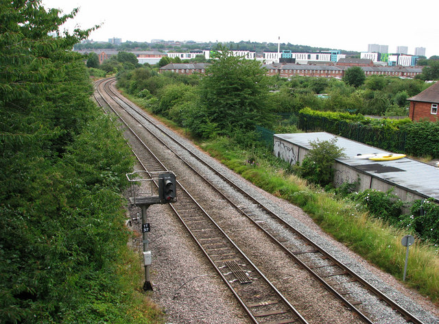
Image: © John Sutton Taken: 12 Jul 2011
The green-and-white buildings in the distance are the Opal 1 student accommodation (Image]) built on land east of the former Radford Station once occupied by sidings, Chettle’s and Butterworth and Walker. This picture updates Stephen McKay’s Image], taken from the same place in 2008, before Opal 1 was built. From the 19th century until the building of Western Boulevard and the council houses either side of it, a railway linking Babbington (Cinderhill) Colliery and the Nottingham Canal at a wharf immediately south of Wollaton Road crossed the Radford-Trowell main line at right angles and on the level here – where the tree on the right of the railway in the middle of this shot is; the colliery railway continued due south on a line corresponding to the boundary between the allotments and the back gardens of the houses on Newland Close (the first of which is on the right) and there were sidings and a weighbridge further south where Marchwood Close now stands. Until the abandonment of the colliery railway there was a signal box here, originally west of the colliery railway and later to the east. Babbington Sidings ran parallel to the main line back under the bridge and almost as far west as Woodyard Lane. For other vestiges of the Babbington Colliery line, see Image], Image], Image] and Image
Images are licensed for reuse under creativecommons.org/licenses/by-sa/2.0
Image Location
Latitude
52.959097
Longitude
-1.1882