Long Bridge and low river levels
Introduction
The photograph on this page of Long Bridge and low river levels by Penny Mayes as part of the Geograph project.
The Geograph project started in 2005 with the aim of publishing, organising and preserving representative images for every square kilometre of Great Britain, Ireland and the Isle of Man.

There are currently over 7.5m images from over 14,400 individuals and you can help contribute to the project by visiting https://www.geograph.org.uk
Long Bridge and low river levels
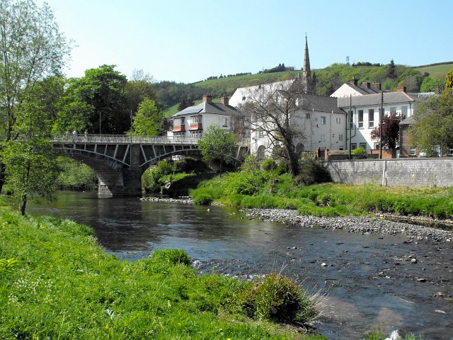
Image: © Penny Mayes Taken: 27 Apr 2011
After the driest April for many years water levels were low enough to paddle across the river here (although I didn't try it). The building with the tile-hung bay windows beyond the bridge is Pont Hafren, a mental health drop-in centre. The large white building to the right is the God The Holy Ghost RC church. The spire belongs to the Crescent church http://www.geograph.org.uk/photo/1141519.
Images are licensed for reuse under creativecommons.org/licenses/by-sa/2.0
Image Location
Latitude
52.517286
Longitude
-3.316845