Cowcross Street
Introduction
The photograph on this page of Cowcross Street by Stephen Richards as part of the Geograph project.
The Geograph project started in 2005 with the aim of publishing, organising and preserving representative images for every square kilometre of Great Britain, Ireland and the Isle of Man.

There are currently over 7.5m images from over 14,400 individuals and you can help contribute to the project by visiting https://www.geograph.org.uk
Cowcross Street
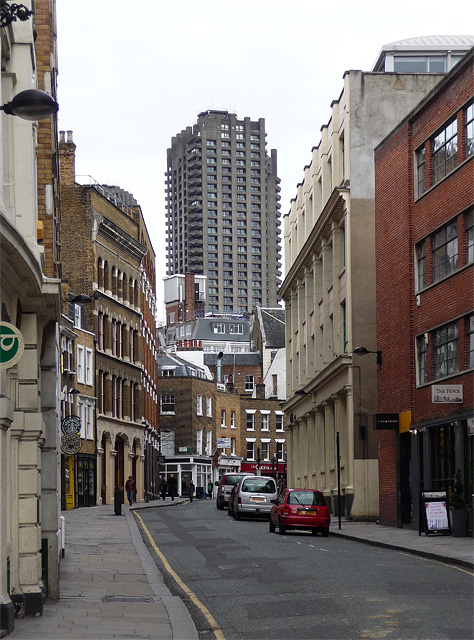
Image: © Stephen Richards Taken: 3 Apr 2010
Cars have long since replaced the cattle which used to be driven along here to Smithfield Market. That stopped in 1855. The road is lined mainly with late-Victorian former warehouses and workshops, now mostly converted into offices or shops. Looming at the end is Lauderdale Tower in the Barbican.
Images are licensed for reuse under creativecommons.org/licenses/by-sa/2.0
Image Location
Latitude
51.520043
Longitude
-0.103192