Railway retaining wall. Railway Terrace Briton Ferry
Introduction
The photograph on this page of Railway retaining wall. Railway Terrace Briton Ferry by Kevin Griffiths as part of the Geograph project.
The Geograph project started in 2005 with the aim of publishing, organising and preserving representative images for every square kilometre of Great Britain, Ireland and the Isle of Man.

There are currently over 7.5m images from over 14,400 individuals and you can help contribute to the project by visiting https://www.geograph.org.uk
Railway retaining wall. Railway Terrace Briton Ferry
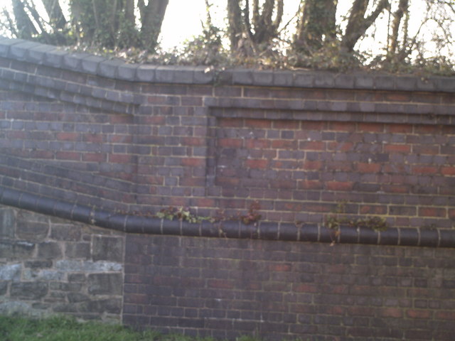
Image: © Kevin Griffiths Taken: 14 Sep 2009
Detail of the railway retaining wall along Railway Terrace. The wall was built with a variety of materials, including red brick and blue engineering brick. Part of the lower part of the wall is brick and part is stone.
Images are licensed for reuse under creativecommons.org/licenses/by-sa/2.0
Image Location
Latitude
51.631923
Longitude
-3.821614