Aerodrome Road, Colindale
Introduction
The photograph on this page of Aerodrome Road, Colindale by Malc McDonald as part of the Geograph project.
The Geograph project started in 2005 with the aim of publishing, organising and preserving representative images for every square kilometre of Great Britain, Ireland and the Isle of Man.

There are currently over 7.5m images from over 14,400 individuals and you can help contribute to the project by visiting https://www.geograph.org.uk
Aerodrome Road, Colindale
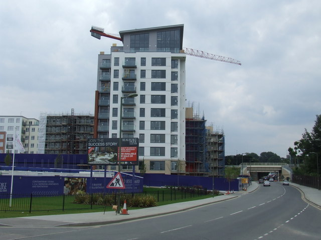
Image: © Malc McDonald Taken: 3 Jul 2011
Aerodrome Road in Colindale. The road passes a large new housing development where several thousand new homes are being built. The railway bridges in the distance have recently replaced narrower, lower bridges which restricted traffic and prevented large vehicles such as buses from using this road.
Images are licensed for reuse under creativecommons.org/licenses/by-sa/2.0
Image Location


Leaflet Map data © OpenStreetMap
Latitude
51.594119
Longitude
-0.240296