Churchfield Lane: former corner shops
Introduction
The photograph on this page of Churchfield Lane: former corner shops by John Sutton as part of the Geograph project.
The Geograph project started in 2005 with the aim of publishing, organising and preserving representative images for every square kilometre of Great Britain, Ireland and the Isle of Man.

There are currently over 7.5m images from over 14,400 individuals and you can help contribute to the project by visiting https://www.geograph.org.uk
Churchfield Lane: former corner shops
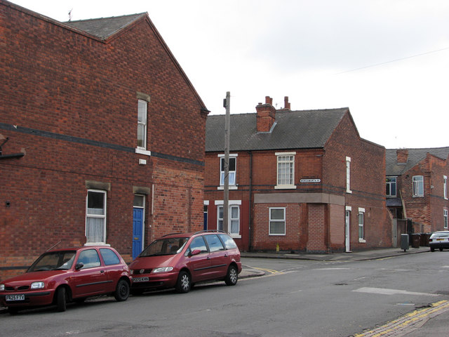
Image: © John Sutton Taken: 12 Jul 2011
The new brickwork shows that the houses on the corners of Wordsworth Road were once shops. Fifty years on, it seems remarkable how many sweet and paper shops once served the children of Bobbers Mill and Radford. This was once on the western edge of Victorian and Edwardian Nottingham. The streets to the west of Churchfield Lane (to the right and behind the camera), extending as far as the River Leen, date from the late 1930s.
Images are licensed for reuse under creativecommons.org/licenses/by-sa/2.0
Image Location
Latitude
52.962817
Longitude
-1.180091