Old disused railway
Introduction
The photograph on this page of Old disused railway by Hywel Williams as part of the Geograph project.
The Geograph project started in 2005 with the aim of publishing, organising and preserving representative images for every square kilometre of Great Britain, Ireland and the Isle of Man.

There are currently over 7.5m images from over 14,400 individuals and you can help contribute to the project by visiting https://www.geograph.org.uk
Old disused railway
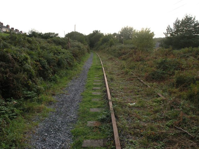
Image: © Hywel Williams Taken: 29 Sep 2006
Part of the Burry Port & Gwendraeth Valley railway, much of this line has now been lifted. It served passengers until 1953, but continued as a mineral line until 1996 when the line closed. It was considered for restoration, but the work to bring it back into operation was considerable and in the end it was closed.
Images are licensed for reuse under creativecommons.org/licenses/by-sa/2.0
Image Location


Leaflet Map data © OpenStreetMap
Latitude
51.763466
Longitude
-4.205436