Railway footbridge, Vanbrugh Hill
Introduction
The photograph on this page of Railway footbridge, Vanbrugh Hill by Stephen Craven as part of the Geograph project.
The Geograph project started in 2005 with the aim of publishing, organising and preserving representative images for every square kilometre of Great Britain, Ireland and the Isle of Man.

There are currently over 7.5m images from over 14,400 individuals and you can help contribute to the project by visiting https://www.geograph.org.uk
Railway footbridge, Vanbrugh Hill
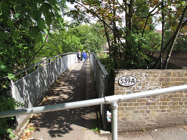
Image: © Stephen Craven Taken: 9 Jul 2011
The footbridge keeps pedestrians off the adjacent road bridge, which although it has footpaths either side could be quite dangerous given the 17% gradient of the road. Note the Network Rail plaque: NKL is North Kent Line and the distance (6 miles 32 chains, or 10.3km) is from Charing Cross.
Images are licensed for reuse under creativecommons.org/licenses/by-sa/2.0
Image Location
Latitude
51.48303
Longitude
0.008045