
Dalkeith High Street improvements
Introduction
The photograph on this page of Dalkeith High Street improvements by kim traynor as part of the Geograph project.
The Geograph project started in 2005 with the aim of publishing, organising and preserving representative images for every square kilometre of Great Britain, Ireland and the Isle of Man.

There are currently over 7.5m images from over 14,400 individuals and you can help contribute to the project by visiting https://www.geograph.org.uk
Dalkeith High Street improvements
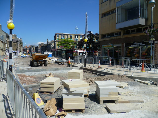
Image: © kim traynor Taken: 3 Jul 2011
Like several towns in the traditional coalmining districts of Midlothian, East Lothian and West Lothian, Dalkeith fell victim to 'modernisation' in the Harold Wilson-era of the 1960s. The heart was ripped out of the town centre, as old Victorian buildings made way for a new town square designed in a more Soviet-influenced style of architecture. With less traffic passing through the town since the creation of the Dalkeith Bypass, Midlothian Council is now attempting to revamp the town centre to attract more shoppers. Unfortunately, this has come at a time of hefty government spending cuts which have depleted Council coffers. http://www.bbc.co.uk/news/uk-scotland-edinburgh-east-fife-12346391 "Dalkeith looks like a town that was hastily rebuilt after terrible bombings, but in actual fact its combination of ruin and Sixties brutalism was entirely planned." -- Stuart Kelly, Scott-land, 2010
Images are licensed for reuse under creativecommons.org/licenses/by-sa/2.0
Image Location

Latitude
55.894073
Longitude
-3.07099