Southwell: Caudwell's Mill, 1993
Introduction
The photograph on this page of Southwell: Caudwell's Mill, 1993 by John Sutton as part of the Geograph project.
The Geograph project started in 2005 with the aim of publishing, organising and preserving representative images for every square kilometre of Great Britain, Ireland and the Isle of Man.

There are currently over 7.5m images from over 14,400 individuals and you can help contribute to the project by visiting https://www.geograph.org.uk
Southwell: Caudwell's Mill, 1993
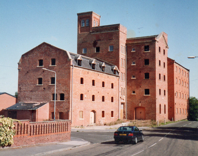
Image: © John Sutton Taken: 31 Aug 1993
Caudwell's Flour Mill was rebuilt several times after disastrous fires, getting bigger with each rebuilding. It closed in 1977. Old photographs show that the tower was once topped by a water tank. The mill was rail served, a siding from the Rolleston-Southwell-Mansfield line (which crossed Station Road behind the camera) terminating under a canopy next to the nearest (Mansard-roofed) part of the building. In 1993 Caudwell's was being converted into flats - Richard Croft's Image] shows the result, in 2007.
Images are licensed for reuse under creativecommons.org/licenses/by-sa/2.0
Image Location
Latitude
53.082425
Longitude
-0.946415