The Red House
Introduction
The photograph on this page of The Red House by Anne Burgess as part of the Geograph project.
The Geograph project started in 2005 with the aim of publishing, organising and preserving representative images for every square kilometre of Great Britain, Ireland and the Isle of Man.

There are currently over 7.5m images from over 14,400 individuals and you can help contribute to the project by visiting https://www.geograph.org.uk
The Red House
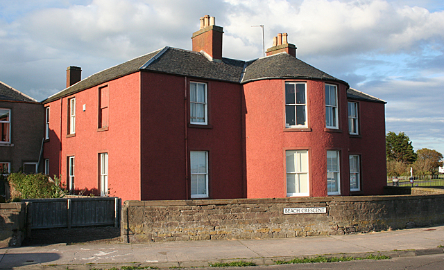
Image: © Anne Burgess Taken: 29 Jun 2011
This house is a category B listed building, described as an early 19th century bow-fronted U-plan villa. It stands on the corner of Beach Crescent and St Vincent Street.
Images are licensed for reuse under creativecommons.org/licenses/by-sa/2.0
Image Location


Leaflet Map data © OpenStreetMap
Latitude
56.464206
Longitude
-2.871462