Suttle House, Wigton Road
Introduction
The photograph on this page of Suttle House, Wigton Road by Rose and Trev Clough as part of the Geograph project.
The Geograph project started in 2005 with the aim of publishing, organising and preserving representative images for every square kilometre of Great Britain, Ireland and the Isle of Man.

There are currently over 7.5m images from over 14,400 individuals and you can help contribute to the project by visiting https://www.geograph.org.uk
Suttle House, Wigton Road
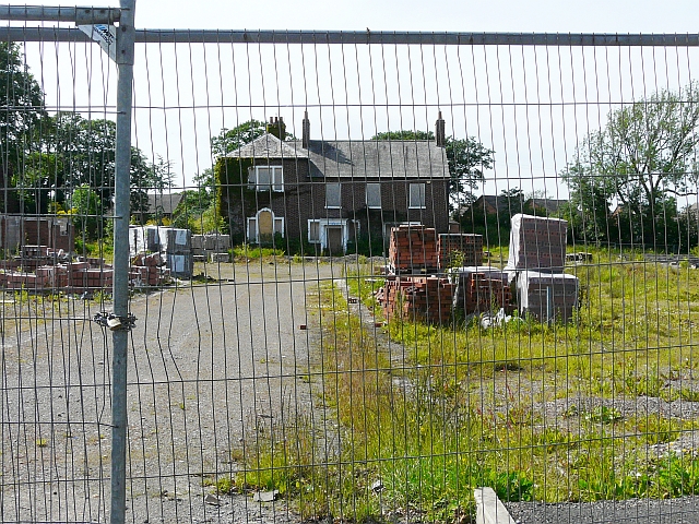
Image: © Rose and Trev Clough Taken: 14 Jun 2011
Built in the late 18th century, originally a farm but as the estate was divided up the house and immediate grounds became a gentleman's residence. The house is a listed building (Grade II). More information, and a picture before it was boarded up, at Images of England http://www.imagesofengland.org.uk/Details/Default.aspx?id=386923&mode=adv . Work started in about 2007/8 on a development of 41 houses and apartments in the grounds of Suttle House, but the builders have put it on hold "due to current market conditions".
Images are licensed for reuse under creativecommons.org/licenses/by-sa/2.0
Image Location
Latitude
54.87937
Longitude
-2.973455