The Steeple Kirk
Introduction
The photograph on this page of The Steeple Kirk by Anne Burgess as part of the Geograph project.
The Geograph project started in 2005 with the aim of publishing, organising and preserving representative images for every square kilometre of Great Britain, Ireland and the Isle of Man.

There are currently over 7.5m images from over 14,400 individuals and you can help contribute to the project by visiting https://www.geograph.org.uk
The Steeple Kirk
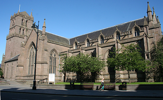
Image: © Anne Burgess Taken: 29 Jun 2011
Odd that it should be called the Steeple Kirk, because it has a tower and no steeple! It is the principal kirk of Dundee, and parts of it date back to the 15th century. There is a detailed history at http://www.thesteeplechurch.co.uk/about-us/history/
Images are licensed for reuse under creativecommons.org/licenses/by-sa/2.0
Image Location
Latitude
56.459318
Longitude
-2.973094