Warmley: Siston or Warmley Brook
Introduction
The photograph on this page of Warmley: Siston or Warmley Brook by Nigel Cox as part of the Geograph project.
The Geograph project started in 2005 with the aim of publishing, organising and preserving representative images for every square kilometre of Great Britain, Ireland and the Isle of Man.

There are currently over 7.5m images from over 14,400 individuals and you can help contribute to the project by visiting https://www.geograph.org.uk
Warmley: Siston or Warmley Brook
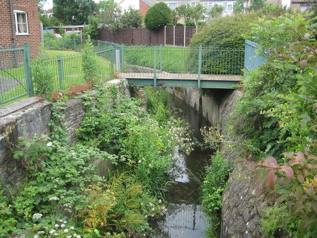
Image: © Nigel Cox Taken: 25 Jun 2011
Current Ordnance Survey maps, and all those from 1903 onwards, show this watercourse as Warmley Brook, eventually flowing into Siston Brook, but the 1882 OS map shows it as Siston Brook in this location. The old maps show a brook meandering through fields, but today it runs through a regular managed concrete channel. This is the view in Deanery Close.
Images are licensed for reuse under creativecommons.org/licenses/by-sa/2.0
Image Location
Latitude
51.460483
Longitude
-2.479551