Woking skyline
Introduction
The photograph on this page of Woking skyline by Alan Hunt as part of the Geograph project.
The Geograph project started in 2005 with the aim of publishing, organising and preserving representative images for every square kilometre of Great Britain, Ireland and the Isle of Man.

There are currently over 7.5m images from over 14,400 individuals and you can help contribute to the project by visiting https://www.geograph.org.uk
Woking skyline
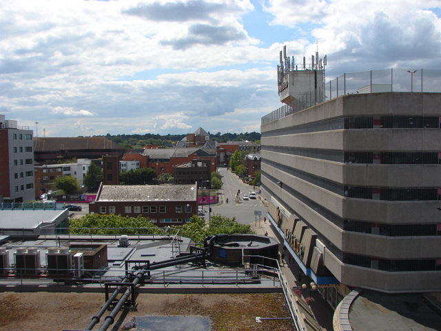
Image: © Alan Hunt Taken: 29 Jun 2011
Looking west from the top level of the main town centre multi-storey car park. In the foreground is the roof of the Wolsey Place shopping centre, The curved balustrade to the right marks the entrance to the Peacock centre. The flat roof with the glass parapet on the left is the facade of Export House, The large office block that can be seen from miles around. On the right is the "Toys-R-Us" car park, the store is on the bottom level. The detached building in the middle distance is the fire station with Church Road West the prominent road on the right.
Images are licensed for reuse under creativecommons.org/licenses/by-sa/2.0
Image Location
Latitude
51.318303
Longitude
-0.561844