Hare Street: Oak Cottage
Introduction
The photograph on this page of Hare Street: Oak Cottage by Nigel Cox as part of the Geograph project.
The Geograph project started in 2005 with the aim of publishing, organising and preserving representative images for every square kilometre of Great Britain, Ireland and the Isle of Man.

There are currently over 7.5m images from over 14,400 individuals and you can help contribute to the project by visiting https://www.geograph.org.uk
Hare Street: Oak Cottage
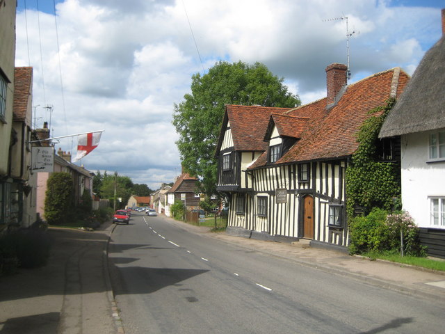
Image: © Nigel Cox Taken: 19 Jun 2011
Nearly four years on from Image and the vegetation seems to have changed the most, particularly the big tree beyond Oak Cottage. Oak Cottage itself is a late mediaeval hall house, said to date from around 1480, and built on a T-plan. It is a Grade II* Listed Building. The road is the B1368.
Images are licensed for reuse under creativecommons.org/licenses/by-sa/2.0
Image Location
Latitude
51.945911
Longitude
0.02138