Manchester Metrolink near St. Werburgh's Road, Chorlton-cum-Hardy
Introduction
The photograph on this page of Manchester Metrolink near St. Werburgh's Road, Chorlton-cum-Hardy by P L Chadwick as part of the Geograph project.
The Geograph project started in 2005 with the aim of publishing, organising and preserving representative images for every square kilometre of Great Britain, Ireland and the Isle of Man.

There are currently over 7.5m images from over 14,400 individuals and you can help contribute to the project by visiting https://www.geograph.org.uk
Manchester Metrolink near St. Werburgh's Road, Chorlton-cum-Hardy
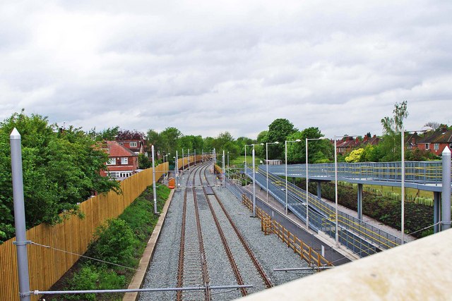
Image: © P L Chadwick Taken: 7 May 2011
The opening of the new extension to St. Werburgh's Road is now imminent. This view is looking in the direction of Manchester city centre. On the right is the access ramp from St. Werburgh's Road. This continues as a footpath under the bridge to give access to the platforms of the St. Werburgh's Road tram stop. Photographed from the bridge carrying St. Werburgh's Road across the tramway, part of the parapet of which is in the right hand bottom corner. Image
Images are licensed for reuse under creativecommons.org/licenses/by-sa/2.0
Image Location
Latitude
53.439593
Longitude
-2.268219