Sandysike Bridge
Introduction
The photograph on this page of Sandysike Bridge by Oliver Dixon as part of the Geograph project.
The Geograph project started in 2005 with the aim of publishing, organising and preserving representative images for every square kilometre of Great Britain, Ireland and the Isle of Man.

There are currently over 7.5m images from over 14,400 individuals and you can help contribute to the project by visiting https://www.geograph.org.uk
Sandysike Bridge
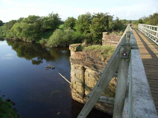
Image: © Oliver Dixon Taken: 24 Sep 2006
The stone piers once supported a bridge on the Waverley line (Carlisle to Edinburgh) over the River Lyne. In 2000, a group of Sustrans volunteers constructed a light footbridge resting on the piers, thereby providing a safe route for cyclists between Carlisle and Longtown avoiding the busy A7.
Images are licensed for reuse under creativecommons.org/licenses/by-sa/2.0
Image Location
Latitude
54.974012
Longitude
-2.960746